| Fachbereiche | |
|---|---|
| Buchreihen (97) |
1382
|
| Nachhaltigkeit |
3
|
| Gesundheitswesen |
1
|
| Geisteswissenschaften |
2372
|
| Naturwissenschaften |
5408
|
| Mathematik | 228 |
| Informatik | 320 |
| Physik | 980 |
| Chemie | 1364 |
| Geowissenschaften | 131 |
| Humanmedizin | 243 |
| Zahn-, Mund- und Kieferheilkunde | 10 |
| Veterinärmedizin | 108 |
| Pharmazie | 147 |
| Biologie | 835 |
| Biochemie, Molekularbiologie, Gentechnologie | 121 |
| Biophysik | 25 |
| Ernährungs- und Haushaltswissenschaften | 45 |
| Land- und Agrarwissenschaften | 1005 |
| Forstwissenschaften | 201 |
| Gartenbauwissenschaft | 20 |
| Umweltforschung, Ökologie und Landespflege | 148 |
| Ingenieurwissenschaften |
1798
|
| Allgemein |
98
|
|
Leitlinien Unfallchirurgie
5. Auflage bestellen |
|
Erweiterte Suche
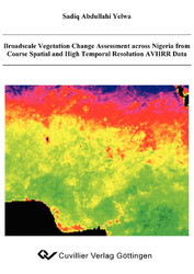
Broadscale Vegetation Change Assessment across Nigeria from Coarse Spatial and High Temporal Resolution AVHRR Data
Sadiq Abdullahi Yelwa (Autor)Vorschau
Inhaltsverzeichnis, Datei (44 KB)
Leseprobe, Datei (65 KB)
Nigeria’s vast land area is mostly covered with natural vegetation. The vegetation cover is
wide-ranging and reflects past and present climatic variations. Nigeria’s vegetation cover is
rapidly changing due to natural and anthropogenic influences. Nigeria’s population growth
rate is one of the highest in the world, where a large proportion of this population are
peasant farmers exploiting the rural environment. Previous studies have shown that
vegetation cover in some parts of Nigeria is fast declining. The report on the
implementation of Agenda 21 (UNCED, 1997) of the United Nations Commission
Conference on Environment and Development (UNCED, 1992), which is a long-term
global action plan for sustainable development, reported that there is still a persistent
decline in the general vegetation cover across Nigeria due to population pressure,
overgrazing and continuous exploitation of marginal lands for various purposes. It therefore
suggests that periodic assessment and management of this vegetation cover for ecological
sustainability would be highly desirable.
With barely $280 GNP per capita and accumulated foreign debts of over US$28 billion, a
cost-effective approach to resource management and monitoring could be appropriate. This
study employs the use of coarse spatial but high temporal resolution Advanced Very High
Resolution Radiometer-Normalised Difference Vegetation Index (AVHRR-NDVI) data
from the Pathfinder Land (PAL) dataset to identify and evaluate vegetation cover change.
This data is administered by the National Oceanic Atmospheric Administration and
National Aeronautics Space Administration (NOAA/NASA) and is, most importantly,
freely available. The datasets used were recomposed into monthly Maximum Value (MVC)
and annual mean composites in order to assess broadly the changes in vegetation cover
across the whole of Nigeria. One hundred and twenty annual gridded point precipitation
data for 12 years at 1° resolution covering the whole country were acquired from the Global
Precipitation and Climatology Centre (GPCC), and were regressed linearly as a function of
13 other variables in order to create models for estimating spatial rainfall data for the whole country.
| ISBN-13 (Printausgabe) | 3867275971 |
| ISBN-13 (Printausgabe) | 9783867275972 |
| ISBN-13 (E-Book) | 9783736925977 |
| Buchendformat | A5 |
| Sprache | Englisch |
| Seitenanzahl | 374 |
| Umschlagkaschierung | glänzend |
| Auflage | 1 Aufl. |
| Band | 0 |
| Erscheinungsort | Göttingen |
| Promotionsort | Universität Stirling |
| Erscheinungsdatum | 20.05.2008 |
| Allgemeine Einordnung | Dissertation |
| Fachbereiche |
Geowissenschaften
Umweltforschung, Ökologie und Landespflege |


