| Departments | |
|---|---|
| Book Series (96) |
1381
|
| Nachhaltigkeit |
3
|
| Gesundheitswesen |
1
|
| Humanities |
2370
|
| Natural Sciences |
5408
|
| Mathematics | 229 |
| Informatics | 319 |
| Physics | 980 |
| Chemistry | 1364 |
| Geosciences | 131 |
| Human medicine | 243 |
| Stomatology | 10 |
| Veterinary medicine | 108 |
| Pharmacy | 147 |
| Biology | 835 |
| Biochemistry, molecular biology, gene technology | 121 |
| Biophysics | 25 |
| Domestic and nutritional science | 45 |
| Agricultural science | 1005 |
| Forest science | 201 |
| Horticultural science | 20 |
| Environmental research, ecology and landscape conservation | 148 |
| Engineering |
1795
|
| Common |
98
|
|
Leitlinien Unfallchirurgie
5. Auflage bestellen |
|
Advanced Search
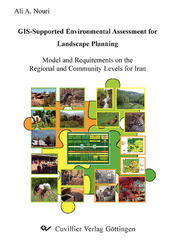
GIS-Supported Environmental Assessment for Landscape Planning (English shop)
Model and Requirements on The Regional and Community Levels for Iran
Ali A. Nouri (Author)Preview
Table of Contents, Datei (58 KB)
Extract, Datei (210 KB)
The lack of an efficient environmental planning and management system has always been considered as a basic problem towards achieving sustainable development in the Caspian Region, North of Iran. The Caspian forests are a globally and nationally important source of Biodiversity, which face numerous threats. During the past decades, the narrow economic base in the mountainous areas and the very limited opportunities for income generation, as well as increasing population pressures led to over utilization of the natural resources by the rural communities. Additionally, a lack of monitoring and of public participation in forestry as well as in other planning sectors increased illegal activities and overutilization of the natural resources by private enterprises and local people. Soil erosion, accompanied by destructive floods and declining fertility as well as productivity, resulted in severe degradation of natural habitats with negative socio-economic consequences. It is clear that the future development of the region should be conducted in a sustainable manner, in which environmental conservation and protection goals can be achieved in company with socio-economic needs of the society. Since 1980, an environment-based land use planning has been developed from an analogue process to a semiautomated one in which, GIS software and Remote Sensing techniques are used, not only to increase the speed but also the accuracy of the planning process. Although, it has been successfully used as a guideline for spatial planning on both national and regional levels, it could not bring efficient andpractical solutions on the local scale. This may partly be caused by legal and administrative constraints, but it also results – to a large extend – from a purely top-down procedure, which does not facilitate an active participation among all stakeholders in both, planning and implementation phases. As this is the best available national planning system, which has been developed so far, all of the efforts should be focused on the enhancement and improvement of its capabilities by identifying and then removing its weaknesses. To achieve this, a comprehensive literature review is made to find the possibilities and alternatives. It seems that “landscape planning” in the modern German meaning of “Landschaftsplanung” could serve as a very effective tool to improve the current process of land use planning in Iran, especially on the local scale. This study presents an analysis of the landscape management problem in order to detect the immediate and underlying threats to the sustainable utilization of the natural resources, esp. forests, in a sample area (Yakhkesh Mountains) of the Caspian mountainous ecosystem. Using questionnaire method, a community (socio-economic) assessment was conducted to gain the ideas and comments of the villagers and local/national experts about the current management system, its weaknesses and possible solutions to prevent negative social as well as ecological consequences of the forest loss. After collecting and processing the available ecological and socio-economic data, a GIS-based ecological assessment
was made using the both Iranian and the German approaches. Some scenarios were developed based on the experiences and results of the past and recent national and international projects across the region. The draft plans were then assessed by both villagers and Iranian experts to finalize the planning scenario. The results revealed that there are many possible solutions to overcome the mentioned problems, which could be presented in an integrated management plan with close cooperation of the all stakeholders. Therefore, an operational mechanism is suggested to use the current development programs in an integrated manner. Although, access to the detailed and up to date data is still a main problem, the available ecological and socio-economic data could be more efficiently used for a participatory nature conservation and landscape management in Iran. This process could be improved through “learn by doing”, which again shows the importance of the implementation and monitoring of the plans that unfortunately remain as a big problem in Iran.
| ISBN-13 (Printausgabe) | 3867275599 |
| ISBN-13 (Hard Copy) | 9783867275590 |
| ISBN-13 (eBook) | 9783736925595 |
| Final Book Format | A5 |
| Language | English |
| Page Number | 214 |
| Edition | 1 |
| Volume | 0 |
| Publication Place | Göttingen |
| Place of Dissertation | Göttingen |
| Publication Date | 2008-04-04 |
| General Categorization | Dissertation |
| Departments |
Forest science
|


