
Cuvillier Verlag GmbH



| Departments | |
|---|---|
| Book Series (99) |
1415
|
| Nachhaltigkeit |
3
|
| Gesundheitswesen |
3
|
| Humanities |
2412
|
| Natural Sciences |
5430
|
| Mathematics | 230 |
| Informatics | 320 |
| Physics | 982 |
| Chemistry | 1371 |
| Geosciences | 131 |
| Human medicine | 246 |
| Stomatology | 10 |
| Veterinary medicine | 112 |
| Pharmacy | 147 |
| Biology | 837 |
| Biochemistry, molecular biology, gene technology | 121 |
| Biophysics | 25 |
| Domestic and nutritional science | 45 |
| Agricultural science | 1006 |
| Forest science | 201 |
| Horticultural science | 20 |
| Environmental research, ecology and landscape conservation | 149 |
| Engineering |
1821
|
| Common |
97
|
|
Leitlinien Unfallchirurgie
5. Auflage bestellen |
|
Advanced Search
Charakterisierung der hydrologischhydrogeologischen Potentiale im Gebiet von Tikaré, Provinz Bam, Burkina Faso (Westafrika) (English shop)
ein Modellbeispiel für Wasserressourcenentwicklung und Management in der südlichen Sahel-Zone
Julien Nikiema (Author)Preview
Table of Contents, Datei (60 KB)
Extract, Datei (350 KB)
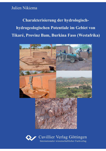
Water is an essential resource for life. For this reason, humankind has always sought to obtain and use natural waters (ASADI et al. 2007). However, the way this resource is handled also shows that this most important foodstuff is threatened by anthropogenic pollution (EFE 2002). The safe management of the water resource in arid countries requires an improvement in the knowledge of surface water and groundwater potentials with regard to water genesis, quality and quantity. In order to contribute to this, the present study has dealt with the hydrological and hydrogeological characterisation of the area of Tikaré in northern Burkina Faso. Lineations and lineation density areas were evaluated by means of remote sensing (use of ASTER data in the VNIR range with ERDAS Imagine and ArcGIS). In addition, a qualitative investigation of the Tikaré reservoir and of the boreholes and wells was carried out through 3 field campaigns and 2 samplings for hydrochemical characterisation and for the isotope signatures of hydrogen and oxygen. In this context, 22 wells, 2 boreholes and 7 samples from surface waters (rivers and lakes) were sampled. The major ions were analysed by ion chromatography (IC), trace elements by ICP-MS (inductively coupled plasma mass spectrometry) and AAS (atomic absorption spectroscopy). The determination of the stable isotopes oxygen (18O) and hydrogen (2H) was analysed by means of equilibration. The regional fracture and fault network shows preferred orientations of 30-70° and of 140-160°. The extents of the various lineations range from 800 to 12000 m. On the basis of the analysis of the regional fracture and fault network, four zones could be delineated which at the same time represent groundwater potential areas. The zones are located in the north-east, south-east, south-west and centre of the study area. They show the following borehole success rates respectively: 60%, 100%, 82% and 63%. In the four delineated zones no borehole had been drilled up to the beginning of these investigations. The use of these areas could positively influence the success rates of boreholes in the study area.
The Tikaré reservoir shows a number of deficiencies in its bed, such as fractures, faults, quarries and erosion areas. The consequences are an increased water loss through infiltration into the laterite aquifer and the surface outcropping of the laterite aquifer. The dam wall shows signs of rill erosion by rainwater. The rapid loss of the water stored during the rainy season was confirmed by a) the progressive enrichment of the heavy hydrogen isotopes (2H V-SMOW) in the groundwater downstream, b) the waterlogged downstream area of the dam and the same water level in wells (downstream) and in the reservoir basin, and c) the high daily measured water loss (6 cm) (compared with the 2 cm/day of the calculated evaporation values). In order to enable a rehabilitation of the reservoir and at the same time to increase water for the socio-economic development of the population, a sealing of the reservoir bed and the construction of a watertight dam wall are recommended.
The groundwaters in the wells are weakly mineralised, with values for electrical conductivity between 90 and 131 S/cm. The major cations and anions investigated are Mg2+, Ca2+, Na+, K+, NO3-, SO42-, Cl- and HCO3-. The Ca2+ ions and HCO3- ions show the highest concentrations both in the dry season and in the rainy season. The average concentrations vary between 9 and 14 mg/l for Ca2+ and 4 mg/l to 247 mg/l for HCO3-. The element concentrations encountered can largely be explained by water-rock interaction in the aquifer. Exceptions are NO3-, K+ and Cl-, which are partly attributable to anthropogenic sources such as manure trenches, latrines and leaching from agricultural areas. The best ion correlations are formed by SO4 and Mg2+ with r ≈ 0.90, Mg2+ and Ca2+ with r ≈ 0.95, Cl- and Na+ with r ≈ 0.95. For the ions Mg2+, Ca2+ and SO42- a correlation with the electrical conductivity could likewise be observed. The fluctuations of the various element concentrations are attributable to dilution and evaporation processes as well as to ion adsorption and ion exchange processes. With reference to the drinking water quality of the World Health Organization (WHO), the limit value for nitrate was exceeded in two wells.
With regard to trace elements, 15 elements were analysed. Mn, Fe and Si are the dominant ones, with mean concentrations of 0.8 mg/l, 2 mg/l to 7.5 mg/l. The trace element arsenic (As), which is a toxic element for humans, generally shows concentrations of < 4 µg/l in the samples investigated. The best correlations are obtained for Ni and Cr with r ≈ 0.93 and for Ba and Rb with r ≈ 0.81. Between the trace elements and the major ions, the best correlations are between SO42- and Sr (r ≈ 0.81), K+ and Rb (r ≈ 0.81), Mg2+ and Sr (r ≈ 0.97) and Ca2+ and Sr (r ≈ 0.90). From the point of view of water quality for human consumption, the WHO standards are exceeded only for Fe in some wells.
The groundwaters from the study area show isotope ratios (V-SMOW) between -3.34‰ and -4.47‰ in the rainy season and -3.31‰ and -4.58‰ in the dry season for 18O. The ratios for 2H vary between -18.6‰ and -29‰ in the rainy season and between -19.6‰ and -38.8‰ in the dry season. The data indicate a greater influence of evaporation and of recharge on 2H than on 18O. In the surface waters, 18O ratios occur between -2.3‰ and -7.5‰ in the rainy season and from +2‰ to +14‰ in the dry season. The 2H ratios fluctuate between -24‰ and -57‰ in the rainy season and +6‰ and +64‰ in the dry season. The results of the ratios in the surface waters can be explained by evaporation in the dry season and by recharge in the rainy season.
The wells in the study area tap the laterite aquifer at depths between 8 and 23 m. The mean water column within the wells is 3 m in the dry season and 10 m in the rainy season. This indicates a direct and rapid infiltration of rainwater into the aquifer. In order to avoid anthropogenic contamination and erosion, protection zones should be designated around the wells and the inner walls of the wells should be cemented. Compared with the wells developed in the laterite aquifer, the boreholes in the weathering and fractured aquifer, at 74 m depth, are considerably deeper. Within the approximately 39 m thick weathering and fractured aquifer, the static water level lies at 20 m and the yield of these boreholes amounts to 2.5 m³/h, which is attributable to the poor site conditions. This shows that investigations of groundwater potential areas are necessary prior to well construction.
As conclusions, it can be stated that the study area possesses a great potential for the use of groundwater and surface waters. This work shows that scientific and technical investigations (geological, hydrogeological and geotechnical) are required for the development of these potentials. These should prevent the construction of reservoirs that cannot retain any water and thus do not fulfil their role in the socio-economic development of the population. Even if the state of groundwater quality is acceptable for drinking water supply, protection zones (especially around the wells) must be defined in order to prevent point-source pollution.
| ISBN-13 (Printausgabe) | 3869550023 |
| ISBN-13 (Hard Copy) | 9783869550022 |
| ISBN-13 (eBook) | 9783736930025 |
| Final Book Format | A5 |
| Language | German |
| Page Number | 208 |
| Edition | 1 Aufl. Anhang extra ausrichten |
| Volume | 0 |
| Publication Place | Göttingen |
| Place of Dissertation | Universität Leipzig |
| Publication Date | 2009-06-09 |
| General Categorization | Dissertation |
| Departments |
Geosciences
|


